What are Company Maps?
|
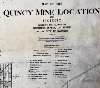
Hundreds of mining companies claimed land in the Keweenaw's "Copper Country." Those that profited kept detailed records including thousands of maps. For instance, the Calumet and Hecla Property Map of 1915 (seen above and available in the Keweenaw Time Traveler) illustrates the residential and commercial properties around the company's primary mining shafts and the town of Red Jacket (now known as Calumet). Similarly, the Quincy Mine Location map of 1898 illustrates not just the company's hoisting and ore processing complexes, but also the surrounding mining "locations" and the communities of Houghton, Ripley, Huron, and Hancock.
|
What can I learn using these maps?
These maps give a unique insight into the built environment of the mining sites and their vicinities. They illustrate the company's industrial complexes and shaft works as well as community parks and commercial and residential lots. These maps also show the water and electric lines, roads, trails, rail and streetcar lines. These maps also illustrate some swamp land, waterways and ponds, some of which no longer exist: such as North Tamarack Pond, Centennial Pond and the Huron Dam Pond.
Other Resources
The Keweenaw Peninsula is fortunate to have multiple professional archives that maintain company records — including thousands of maps! — for use by researchers. If you want to explore more maps that are not available in the Keweenaw Time Traveler, contact the archivists at these libraries for more information about accessing maps of the Keweenaw.
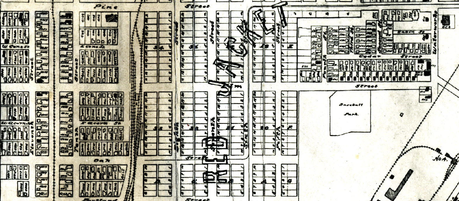
Map above: "Calumet and Vicinity," 1915. Keweenaw National Historical Park, National Park Service, C&H Acc-400


