Fire Insurance Plans
Fire Insurance Plans (FIPs) were used by insurance companies from the mid-1860s through the 1960s to determine the risk of fire, the greatest threat to structures. Employees traveled to cities and towns all over North America to take detailed notes about each building - What it was made of and its proximity to fire hazards and hydrants. They produced hand-colored maps bound in large folio volumes, which they sold to insurance companies, updating the volumes every 5-10 years. These maps provide historians and geographers the greatest detail on our urban spaces of the past. Sanborn Map & Publishing Co., based in New York City, was one of the companies producing these maps. The Keweenaw Time Traveler uses the Sanborn FIPs and geographic information systems (GIS) to recreate a model of the Keweenaw during different parts of our history.
|
If you are interested in the Sanborn story, watch this video on the history of the company.
|
Jim Epstein, "The Story of the Sanborn Mapping Company," (2008)
|
How do we read them?
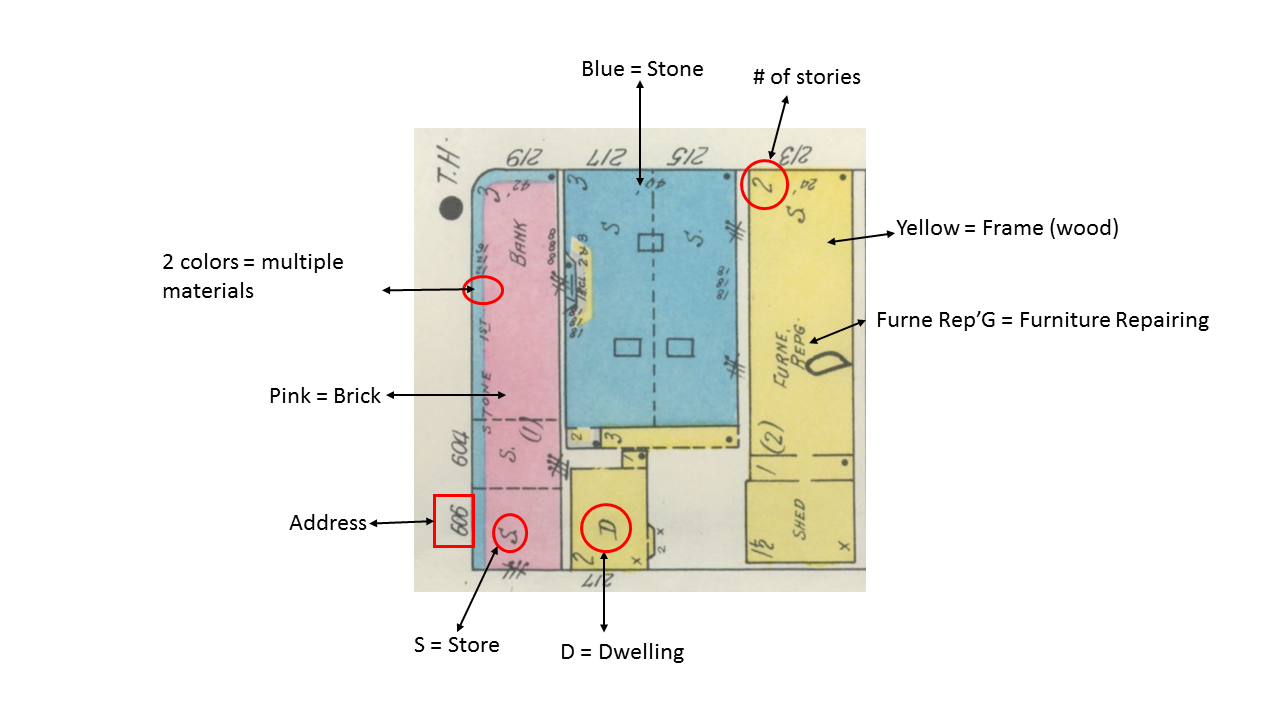
This image is a typical block on a Sanborn FIP. The symbolism and color-coding was standardized nationwide so we can determine a lot of information within seconds. At a glance, we can determine a building's materials, number of floors, address, and its primary use.
Additional colors we might see include:
Brown for adobe
Gray for metal or iron
Green for special
The Library of Congress offers further explanation of Sanborn keys here.
Many businesses are listed with an abbreviation for the profession or use, and it might be difficult to understand what these stand for. For an explanation of these abbreviations, please download:
| |||
Sanborn FIPs offer unique views of the past. If you enjoy learning about them and want to know more, check out our extended page on Sanborn FIPs.


