What are Topographic Maps?
A topographic map is a two-dimensional representation of the Earth’s three-dimensional landscape. Contour lines indicate elevation above sea level to show hills, cliffs, and general elevation change. A topographic map also includes detailed and accurate illustrations of human-made and natural features on the ground such as roads, railways, power transmission lines, rivers, lakes and geographical names. The topographic maps used in the Keweenaw Time Traveler come from the United States Geological Survey.
What can I learn using these maps?
Topographic maps identify numerous ground features, which can be grouped into the following categories:
- Topography: mountains, valleys, slopes, depressions as defined by contours
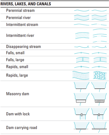
- Hydrography: lakes, rivers, streams, swamps, rapids, waterfalls
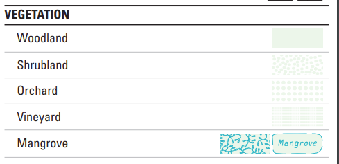
- Vegetation: wooded areas, barren areas, rocky outcrops and fields
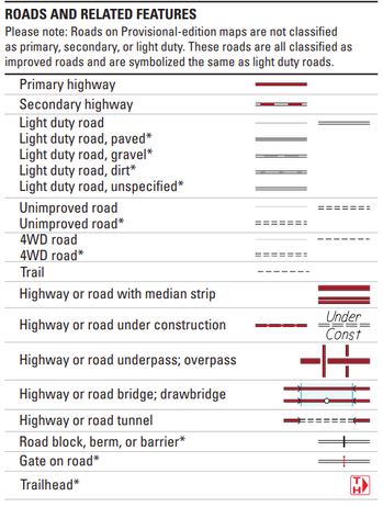
- Transportation: roads, trails, railways, bridges, airports/airfield
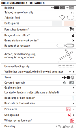
- Built Environment: buildings, urban development, power transmission line, pipelines, towers
- Boundaries: international, provincial/territorial, administrative, recreational, geographical
- Place Names: town names, water feature names, landform names, boundary names
|
|
|
Tips & Tools for Reading these maps
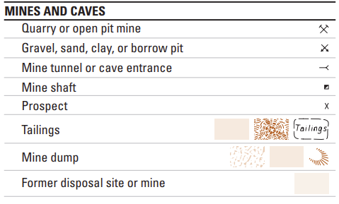
For information on how to read a topographic map as well as commonly used symbols please view: Topographic Map Symbols by the USGS
|
|


