 Anishinabe youth from across the Lake Superior Region have made their way to Fond du Lac Tribal and Community College to attend a Geospatial Summer Camp that is taking place over the next two weeks. This camp focuses on developing computer literacy and Geospatial skills to help solve community identified problems. The camp integrates these technical skills with traditional teachings, cultural practices, and public engagement methods to develop a uniquely Indigenous approach to GIS. Students are engaging with lessons developed by Ph.D. Candidate James Juip that uses the Keweenaw Time Traveler to not only develop their geospatial skills but learn about the past and how it shapes our present landscapes. Students are taking the lessons they learn to develop their own storymaps that share their experiences as Indigenous youth. This camp will continue to run each summer. For more information about these unique experiences and how you can be involved contact Courtney Kowalczak, Environmental Institute Director, [email protected]
0 Comments
This week Michigan Technological University’s Social Sciences Department hosted the Vernacular Architecture Forum’s Annual Conference. Conference attendees came from all over the United States to explore the buildings and landscapes that tell the stories of copper mining, immigration, urban growth along with stories of post-industrial patterns of recovery, reinvention, and re-interpretation. Dr. Sarah Fayen-Scarlett and Dr. John Arnold led a team from the Keweenaw National Historical Park, Michigan Technological University, the Keweenaw County Historical Society, Visit Keweenaw and countless Copper Country community members to create three memorable field trips that showcase some of these special places. You can explore these memorable places on the Keweenaw Time Traveler mobile website. Each of these unique places is marked with a star in a purple circle, click on the circle and explore these special spots that will be toured by the Vernacular Architecture Forum. The Keweenaw Time Traveler also held special events for V.A.F. participants including Historic Landscape Bingo. Both the Daily Mining Gazette and the Vernacular Architecture Forum have more coverage of this unique conference experience.
 Dr. Sarah Fayen-Scarlett and Ph.D. Candidate James Juip presented to the Chassell Lions Club on the recent additions to the Keweenaw Time Traveler historical atlas and community engagement and outreach efforts. The pair discussed the recent additions of Calumet and Hecla mining company records into the Time Traveler as well as the massive increase in engagement with the Keweenaw Time Traveler from across the world. The Chassell Lions Club had great questions about how the Time Traveler could be used and what plans are for the Keweenaw Time Traveler for the future. If you are interested in having the Keweenaw Time Traveler team present to your local organization, please contact [email protected] for more information.
Members of the Keweenaw Time Traveler Team presented their work at the Annual Meeting of the Society of Industrial Archeology conference in Minneapolis - Saint Paul this week. Dr. Dan Trepal shared his work entitled: ‘Mapping Hamtramck: Reconstructing Industrial Urban Landscapes for Public Archaeology and Heritage’. While Ph.D. candidate James Juip presented his work on creating meaningful engagement in digital heritage projects.
The Mapping Hamtramck project brings together the Hamtramck Historical Museum, Wayne State University, and the Keweenaw Time Traveler team in Michigan Technological University's Geospatial Research Facility, with generous financial support from the National Endowment for the Humanities in an effort to reconstruct the industrial and urban landscape of Hamtramck’s past. Using the Keweenaw Time Traveler as a case study James Juip’s work fills a gap in public participatory GIS research by proposing a new model that measures both the volume and depth of participation grown through public outreach activities. His presentation also described the value of this model in investigating and evaluating the current engagement program in use by the Keweenaw Time Traveler team.
The Keweenaw Time Traveler received a Governor's Award for Historic Preservation in a special ceremony at the Michigan State Capital building on Thursday. This award acknowledges the unique work the Keweenaw Time Traveler team has done to preserve and connect people to the historic landscape of Michigan's Copper Country through the creation of the Keweenaw Time Traveler Historic Atlas.
“The Governor’s Award for Historic Preservation celebrates the collaborative spirit fueling MTU’s Keweenaw Time Traveler project,” said Don Lafreniere, KeTT program director and Department of Social Sciences chair. “We are very honored to have been recognized by the Michigan Economic Development Corporation and the State Historic Preservation Office for our work.” In its 21st year the Governor’s Awards for Historic Preservation program was created by the Michigan SHPO to celebrate outstanding historic preservation achievements that reflect a commitment to the preservation of Michigan’s unique character and the many archaeological sites and historic places that represent our rich past. The Keweenaw Time Traveler has always been a truly collaborative effort. The digital atlas brings together historical data from archival collections from across the region — including the Michigan Tech Archives, the National Park Service, Keweenaw History Center, and the historical societies of Keweenaw, Houghton, and Ontonagon counties linking the data across time and space. Over 45 students, faculty and staff from across Michigan Tech's campus have worked in collaboration with local and regional partners and countless members of the Copper Country community to make this possible. This project would not be possible without the generous financial support of the National Endowment for the Humanities, the Council on Library and Information Resources, the Keweenaw National Historical Park Advisory Commission and the Portage Health Foundation.
Explore the 2024 Governor's Awards Ceremony and other awarded projects through the videos below:
Discovering the U.P. broadcasted their 80th episode on TV 6 last night. The episode shared the 5-year partnership between the Chassell Heritage Center, the Michigan Technological University Social Sciences, the Keweenaw Time Traveler, Chassell High School and a dedicated group of volunteers that brought about the creation of the Chassell Heritage Trail.
The trail shares the, often overlooked, story of the lumber milling operations in Chassell. The Keweenaw Time Traveler not only helps guests visualize the former mill landscape through historic maps, but also works to interpret the site for children through a digital storybook trail. 'Stanley the Strawberry's Great Adventure' is designed to engage young children in the history of the lumber industry in Chassell. In this short children's book Stanley the Strawberry discovers this forgotten past with the help of Sheila the Shingle and friends. Work on the trail was extensive. It involved historical research and site archeology done by members of the Michigan Technological University Social Sciences Department. Chassell Township School students helped design the interpretive signs based on this research. A generous grant from the John and Melissa Besse Foundation made this work possible. The grand opening of the trail took place in July, 2023. The trail is free and open to all. 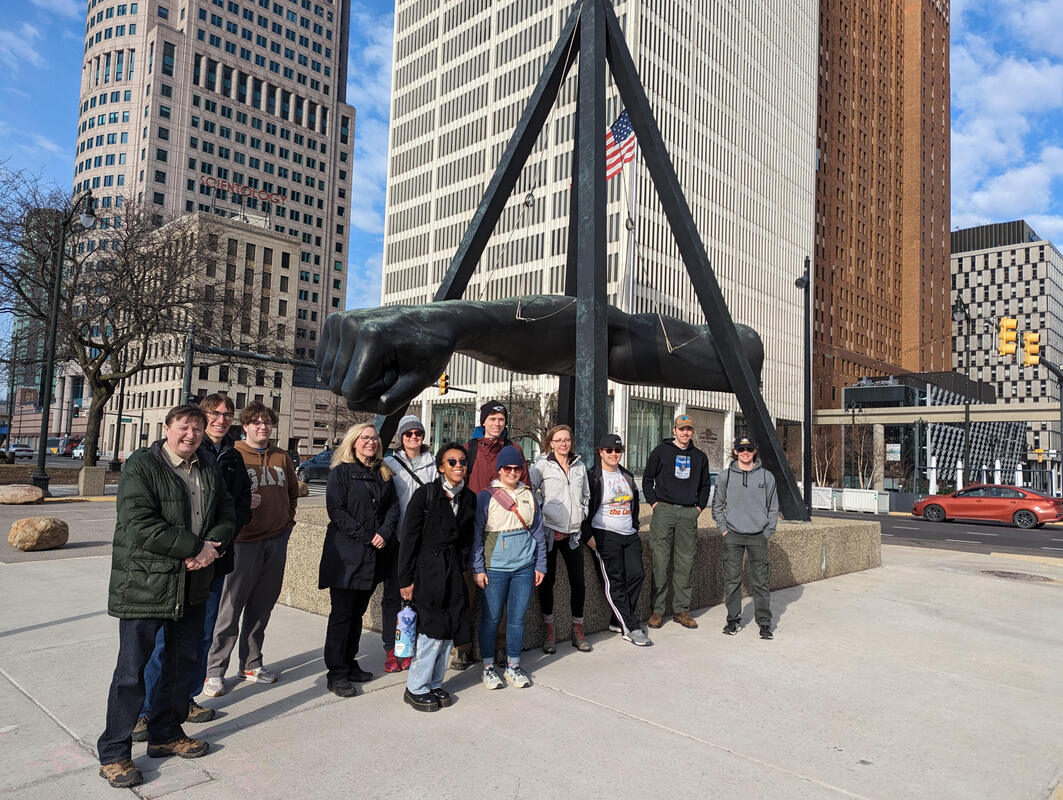 Students in the Department of Social Sciences study away program in Detroit collaborated with community partners in the Jefferson-Chalmers neighborhood of the city. Students produced 4 storymaps that highlight the history, sustainability, and resilience of the neighborhood as it has grappled with racial segregation, urban renewal, and climate change induced flooding. Click on the link below to explore these storymaps, watch live presentations on the area's history, and learn more about the neighborhood: The Detroit Study Away Program is led by Drs. Laura Rouleau and Don Lafreniere with support from the Department of Social Sciences, Geospatial Research Facility, Center for Innovation in Sustainability & Resilience, Center for Diversity and Inclusion, and the Dean of Students Office.
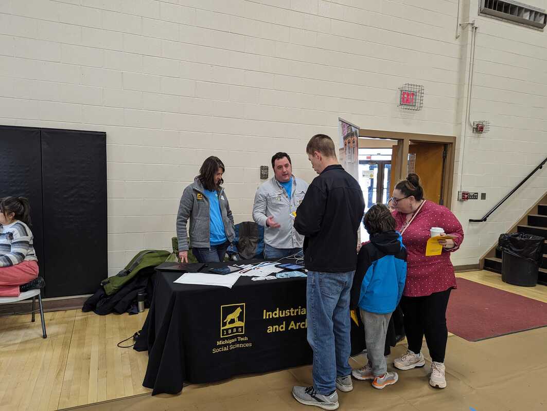
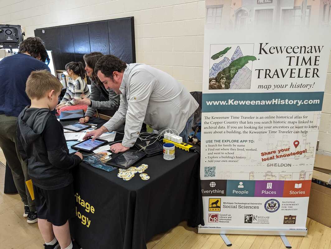
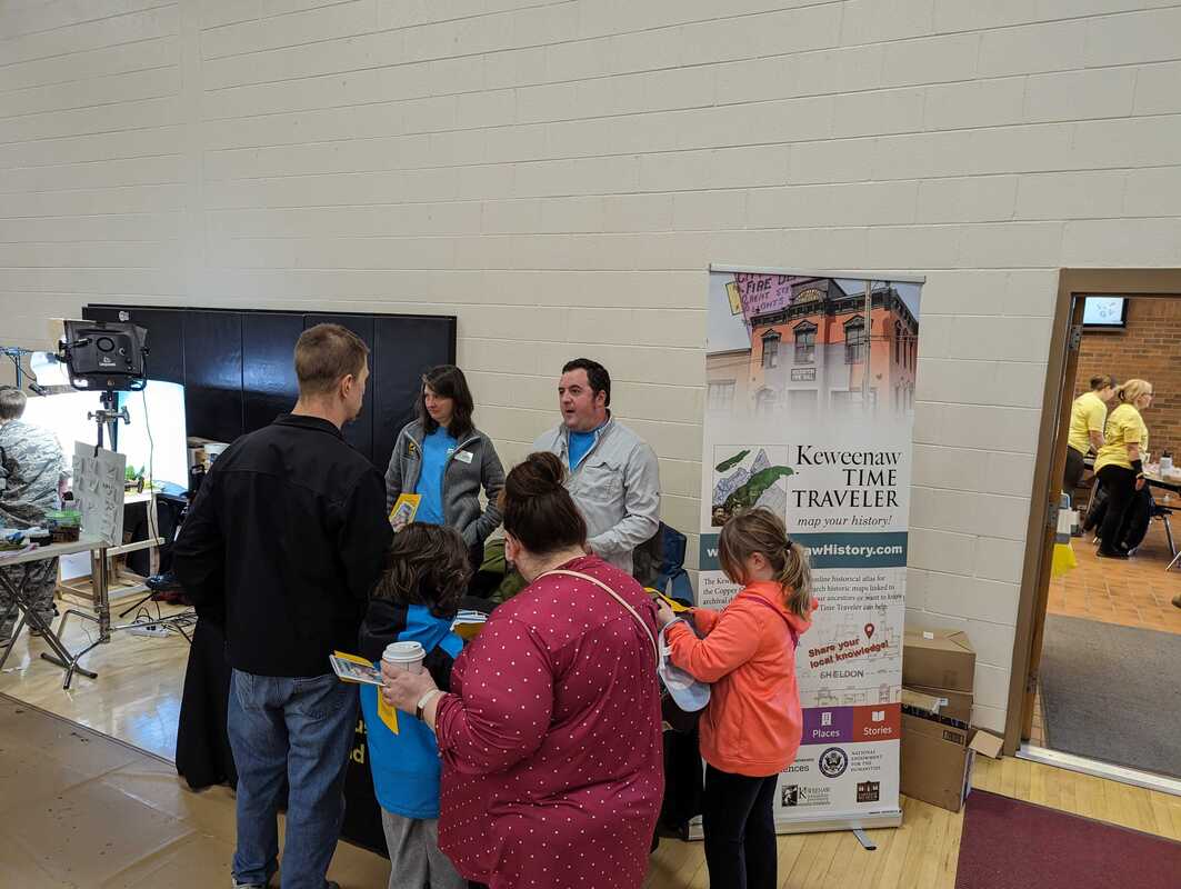
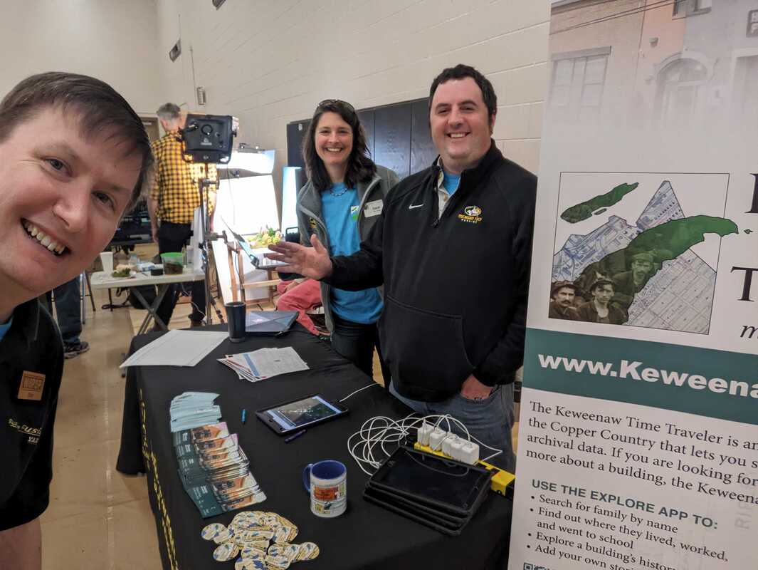 This Saturday the Keweenaw Time Traveler team attending MakerFest 2024: Making in Progress. This fun and family friendly event was hosted by Superior Fab Lab in the Houghton High School complex. The Keweenaw Time Traveler was one of the 21 featured makers from across the Copper Country that shared their crafts at the event. Guests could learn everything from how to make guitar FX pedals, knit and crochet, how to operate a letter press and even how to grow their own mushrooms at home through interactive exhibits. Over seventy people stopped by the Keweenaw Time Traveler booth and explored the history of the Keweenaw through games, stories, and our digital atlas. Visitors to the Time Traveler booth could play KeTT Bingo, draw their favorite Copper Country memory, write a post card to a friend, or just explore the people, places and stories that make up our history. The team also gave a short presentation on the creation of the Time Traveler and its many uses. The Keweenaw Time Traveler attended this year's regional History Competition held at Michigan Technology University. The Michigan History Day Competition encourages students across the state to explore history from both local and global scales and prepare a variety of exhibits that share what they learned. Students from across the Western Upper Peninsula can create documentaries, historical performances, exhibits and websites and enter the regional competition sponsored by the Michigan Technological University Social Sciences Department and the Michigan Tech Archives. This year all of the participants came from Lake Linden.
The theme for this year was "Turning Points in History", but students took this theme and developed a wide variety of projects on many themes from the Italian Hall disaster to the discovery of penicillin. Other exhibits included the development of the V-2 rocket and its impact on early experiments in manned space travel and a special documentary on MKUltra, a CIA project that researched unique methods of information extraction including psychoactive drugs and electroshock. Winners of the regional competition have earned a spot in the State Finals taking place April 20th at Central Michigan University. For more information about the History Day Competition explore this article published by the Daily Mining Gazette. Members of the Historical Environments Spatial Analytics Lab presented recent scholarly work at the Social Science History Association meeting in Washington DC this week.
Senior Research Associate and Community Outreach Coordinator James Juip presented his most recent work on meaningfully engaging public stakeholders in deep mapping projects. James discussed the value of engaging the public Historic Geographic Information Systems (HGIS) projects for researchers and community members alike. He presented his newly created methodological framework for both measuring and creating participation in digital mapping projects and how that model was used to create programming for the Keweenaw Time Traveler during the last year; resulting in Time Traveler programming reaching over 40,000 individuals, creating 700 new Time Traveler Users and developing several new community partnerships. Immediately following this presentation Project Director Dr. Don Lafreniere gave a presentation entitled, 'Fostering a Next-Generation of Scholars in Historical Geography and GIS' co-authored by Dr. Dan Trepal and Dr. Sarah Fayen-Scarlett. Don discussed the recent work done by members of the Historical Environments Spatial Analytics Lab and how community and interdisciplinary collaboration has been central to the success of the Keweenaw Time Traveler. Dr. Lafreniere proposed a summit on Deep Mapping housed at Michigan Technological University, where scholars and interested parties from across the world could come and learn methodological approaches to successful deep mapping. |
|

 RSS Feed


