|
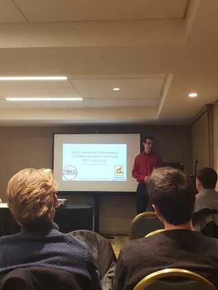
Faculty and students from the Historical Environments Spatial Analytics Lab were well represented at the annual meeting of the Social Science History Association in Chicago this past week.
Tim Stone and Don Lafreniere presented "Built Environment Determinants of Childhood Health in the Early 20th Century City." The paper uses data from the Copper Country Historical Spatial Data Infrastructure (The back end of the Keweenaw Time Traveler) to follow 1600 students in Calumet and Laurium through their daily journey to school and measure the potential risk from industrial activities in the region. Gary Spikberg, Robert Pastel, and Don Lafreniere presented "A Semiautomated approach to Creating Record Linkages and High Resolution Geocoding Across Historical Datasets." This paper outlines the algorithms used to parse and map local city directories. Read more about them here. Dan Trepal and Don Lafreniere presented "Understanding Cumulative Hazards in a Rustbelt City: Integrating GIS, Archaeology, and Spatial History." This paper presents a methodology for modelling industrial hazards across a city. It utilized data from the Imagining London Project Director Don Lafreniere presented "Socio-Spatial Mobility and Urban Environments in the 19th Century City" and participated as a panelist discussing challenges and lessons learned in multi-year historical GIS projects.
0 Comments
Congrats to HESAL Director Dr. Don Lafreniere for being elected to the Executive Committee of the Social Science History Association for a three-year term.
History pedagogy, or the approach to teaching history, has been revolutionized by HGIS through instruction on spatial thinking skills, and enabling the concept of ‘community-engaged teaching’. Three case studies are described in the article, wherein faculty and graduate students engaged with local communities and heritage organizations by providing access to historical data in a GIS interface with community-led applications. Those involved in each example were not just able to review facts and statistics. They were able to view a landscape in history, while walking through it in the present, and they learned about the culture of their region while doing it.
To learn more about the walk through Lake Linden using an HGIS map, which is discussed in the article, check out KeTT’s blog post from July 21, 2016. If you haven’t checked out the Keweenaw Time Traveler's Explore App yet, click here |
|


 RSS Feed


