Faculty Recognized for Providing Students with Experiential/Service-Learning Opportunities2/29/2020 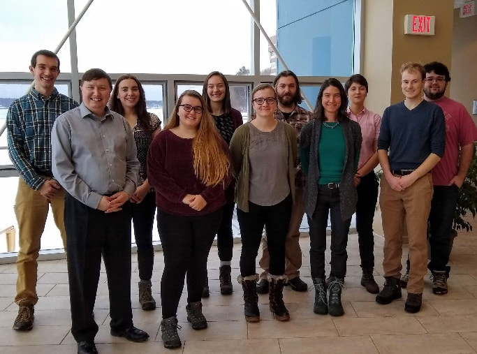 Faculty and Students who collaborated on the Houghton Safe Routes to School Project HESAL Director, Dr. Don Lafreniere and Dr. Richelle Winker (MTU Sociologist) were recognized this week by the Dean Hemmer of the College of Sciences and Arts and for their creative, out-of-the-box approach to providing students with an experiential/service-learning opportunity. In Fall 2019, students in two classes, Dr. Winkler's ‘SS4700 Communities and Research’ and Dr. Lafreniere's ‘SS4050/5050 Advanced GIS’, worked together on a project to conduct research to inform decision-making related to applying the 'Safe Routes to School' program to Houghton. This is a national program that promotes walking and biking to school in conjunction with safety education, infrastructure improvements, traffic enforcement, and incentives. In the project, students analyzed current practices associated with students getting to and from Houghton schools, assessed the level of community interest in the goals of the Safe Routes program, determined potential issues associated with pursuing those goals. The goal was to provide community members with a solid base of data to inform decisions related to the Safe Routes program. Neither class could have conducted the research independently as well as they did through collaboration. Students in ‘Communities and Research’ could and did collect data through surveys, interviews, public meetings, and meetings with school and city officials (as that class focused on methodologies for accomplishing such tasks) but they could not perform the spatial analysis at a level needed to be useful. On the other hand, students in ‘Advanced GIS’ could perform the desired spatial analysis but they were not in a position to engage stakeholders at the level required to get this project going. 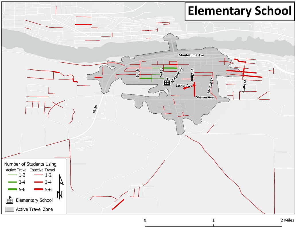 Example of mapping and analysis completed during the project Winkler and Lafreniere came up with the idea of collaboration well before the semester started. They proactively scheduled their classes in overlapping time slots, which allowed students in the two classes to meet together for 50 minutes each week. The small class sizes--seven students were enrolled in one class and eight in the other—meant the group was small enough to keep everyone fully engaged.
All data and the final report are available on the Houghton Safe Routes to School website. The project also resulted in the establishment of a group to address the actions in the report called the Houghton Safe Routes to School Core Planning team. Dean Hemmer praised their work as “an innovative way to integrate the work from two different courses into an exciting community research project.” He continued, “It is wonderful when Michigan Tech can give back to the community while simultaneously giving our students interesting and relevant research opportunities.” Students saw extraordinary benefits; in addition to the typical course work, they learned from each other. Students in “Communities and Research” learned a good deal about spatial analysis using GIS and the “Advanced GIS” students learned a lot about how to conduct community-engaged research. Because of this synergy, both see the potential for implementing these kinds of collaborations in a variety of disciplines.
1 Comment
12/12/2022 09:28:24 am
It is wonderful when Michigan Tech can give back to the community while simultaneously giving our students interesting and relevant research opportunities. I truly appreciate your great post! Leave a Reply. |
|
 RSS Feed


