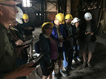
 Dr. Don Lafreniere and Dr. Tim Scarlett discussing use of GIS and Remote Sensing in Industial Archaeology Dr. Don Lafreniere and Dr. Tim Scarlett discussing use of GIS and Remote Sensing in Industial Archaeology Research Associates from the Human Environments Spatial Analytics Lab and the Keweenaw Time Traveler project worked this weekend with Dr. Tim Scarlett (MTU Social Sciences) and others at the Quincy Smelter Works to highlight for MTU Alumni how we use remote sensing and GIS to support the preservation and interpretation of industrial heritage sites. The research team is using a suite of geospatial technologies—including Ground Penetrating Radar, LiDAR, Photogrammetry, Thermal and spectral imaging, among others. HESAL staff built an web-based Historical GIS (see links below) to document how the property has changed over time, help the scientists examine the remote sensing and geospatial data, enable digital exhibitions and tools for public education, and help the site managers make wise decisions about the vast cultural resources at the site. 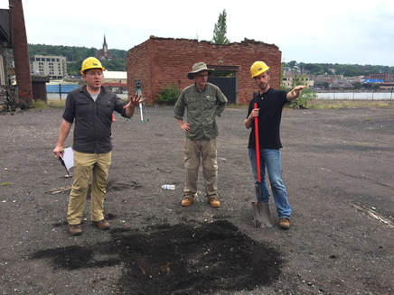 Dr. Tim Scarlett, Dr. Sean Gohman and Ryan Williams, GISP You can read more about our collaboration on the HESA Lab website at historicalgis.com/quincy
Link to our Smelter Archaeology WebGIS Link to our Smelter Historical GIS
1 Comment
|
|
 RSS Feed


